Encadrants
Cathy Quantin-Nataf (Université Lyon1/France) and Alain Herique (Université Grenoble Alpes/France)
Context
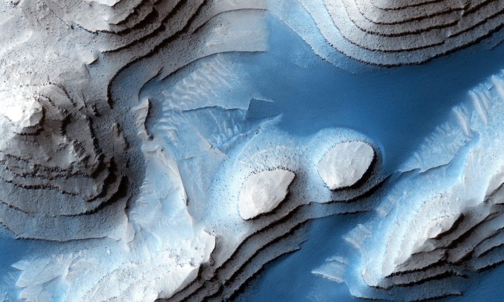
The Martian missions have gradually revealed that Mars abounds with evidence of a full ancient hydrological system favorable to life emergence. If so, we can expect ancestral sedimentary deposits in basins or in the Martian lowlands. Recent advances in the analyses of the surface of Mars suggest that buried Noachian deposits may be ubiquitous and locally exhumed. Different dataset can be used to study buried layers including surficial data (optical or hyperspectral), but also orbital low frequency radar data from MARSIS/Mex and SHARAD/MRO. However, penetrating radar data are still little used for subsurface geological investigations while they are crucial complementary dataset to surface data. The main reason is that the surface clutter of the rough surface of Mars is creating many reflectors inducing an ambiguity in radargrams between deep reflectors of interest and slant surface reflectors arriving at the time. The deconvolution of the surface clutter is so crucial to interpret the data in terms of subsurface structures. The classical approach for such deconvolution is to use the global altimetry data set (200m/pix) (Nouvel et al 2003, Carter et al., 2009), but at this low spatial resolution, many clutters are missed. Optical DTMs provide better resolution. However, their use remains limited due to their coverage and the presence of artifacts (Desage et al., 2023).
The goal of this PhD project is to better use higher resolution terrain models (10m/pix) to simulate the surface clutter in the goal to highlight geological reflectors possibly linked to buried layers especially in the region of the Martian dichotomy (transition between Martian low and highlands) and to complementary analyze their 3D geological context.
Methodology and work program
SHARAD (Mars SHAllow RADar sounder, onboard Mars Reconnaissance Orbiter) ground penetrating radar has the ability to sound the first few hundred meters of the subsurface with a vertical resolution of 15m and a horizontal resolution of few hundred meters (Seu et al., 2007).
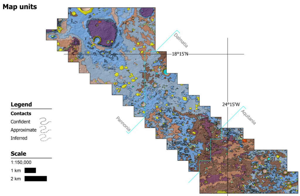
To better simulate the surface clutter and remove ambiguities, we need elevation data at higher spatial resolution but with a coverage large enough to cover around 50 km on both side of the radar track. CTX Digital Elevation Models (DEMs), obtained by stereo-photogrammetry of CTX images (Beyer et al., 2018; Michael C. Malin et al., 2007), are about 10m/pix and cover about 17% of the surface of Mars allowing in certain places mosaicking of DEMs larger than 100 km. For instance, such mosaic of CTX DEMs has been produced and used to characterize the landing site of ExoMars (Volat et al., 2023).
We have developed a new pipeline allowing the mosaicking CTX images around SHARAD track to simulate the surface clutter of the observed SHARAD data. The pipeline has been delivered but all the tests and use cases in different geological context still need to be done.
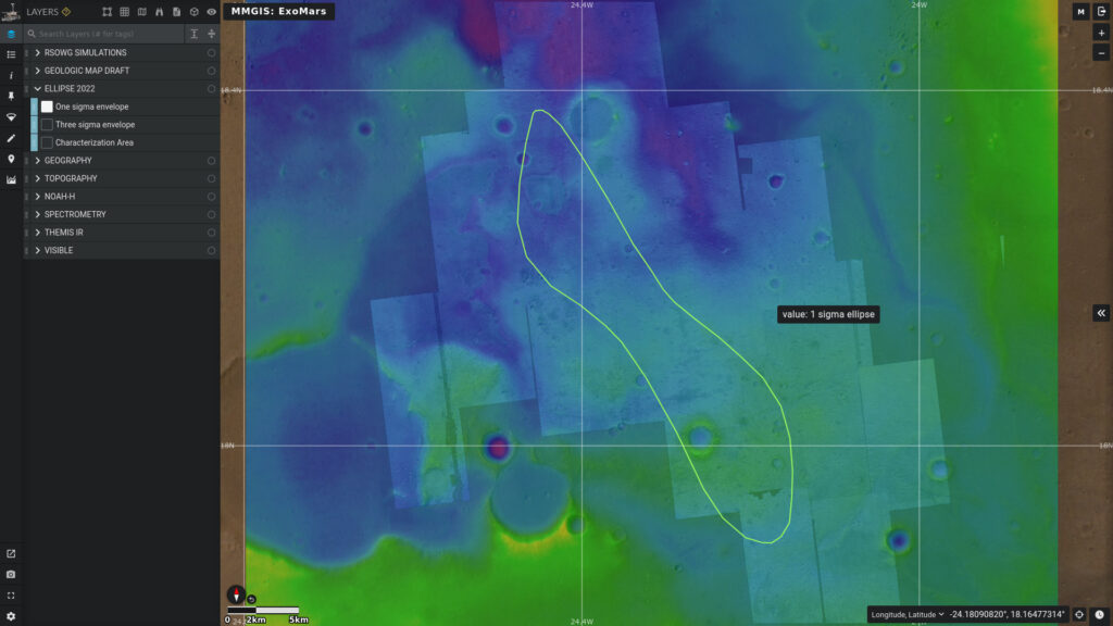
The familiarization with methods and pipeline is the first part of the PhD. Geophysical interpretations and/or automated data analysis methods will be developed by the second part. The study of Oxia Planum region will for instance contribute to the characterization of the ExoMars landing site while being a study case for the pipeline validation. Then, key locations of the surfaces of Mars along the Martian dichotomy will then be analyzed and interpreted.
Required skills
The subject is between physics and planetary geosciences. We expect candidate to have solid physical background and knowledge (or at least interest) in Geosciences. Experience with penetrating radar data is not mandatory but is an advantage.
Application
CV and Cover letter to be send to cathy.quantin@univ-lyon1.fr before April 15st 2024.
Bibliography
- Carter, L. M., Campbell, B. A., Watters, T. R., Phillips, R. J., Putzig, N. E., Safaeinili, A., et al. (2009). Shallow radar (SHARAD) sounding observations of the Medusae Fossae Formation, Mars. Icarus, 199(2), 295–302. https://doi.org/10.1016/j.icarus.2008.10.007
- Beyer, R. A., Alexandrov, O., & McMichael, S. (2018). The Ames Stereo Pipeline: NASA’s Open Source Software for Deriving and Processing Terrain Data. Earth and Space Science.
- Malin, Michael C., Bell, J. F., Cantor, B. A., Caplinger, M. A., Calvin, W. M., Clancy, R. T., et al. (2007). Context Camera Investigation on board the Mars Reconnaissance Orbiter. Journal of Geophysical Research E: Planets, 112(5), 1–25. https://doi.org/10.1029/2006JE002808
- Seu, R., Phillips, R. J., Biccari, D., Orosei, R., Masdea, A., Picardi, G., et al. (2007). SHARAD sounding radar on the Mars Reconnaissance Orbiter. Journal of Geophysical Research E: Planets. https://doi.org/10.1029/2006JE002745
- Volat, M; Quantin-Nataf, C; Dehecq, Digital elevation model workflow improvements for the MarsSI platform and resulting orthorectified mosaic of Oxia Planum, the landing site of the ExoMars 2022 rover, PLANETARY AND SPACE SCIENCE, 10.1016/j.pss.2022.105552, 2022
- Desage L., Herique A., Douté S., Zine S., Kofman W., Resolving Ambiguities in SHARAD Data Analysis Using High-Resolution Digital Terrain Models, Remote sensing, https://doi.org/10.3390/rs15030764, 2023